
ECOLOGICAL MEDIATORS
Fostering Resilient, Connected and Accessible Riverscapes for Quebec City
Competition Date: July-August 2017
Type: City Planning and Landscape
Pari Riahi, Team leader
Rachel Loeffler, Registered Landscape Architect, ASLA
Dr. Allison Roy, U.S. Geological Survey, Massachusetts Cooperative Fish and Wildlife Research Unit, Department of Environmental Conservation, University of Massachusetts
Michael Caine, (BARCH 2018)
Kevin McManus, (BARCH 2019)
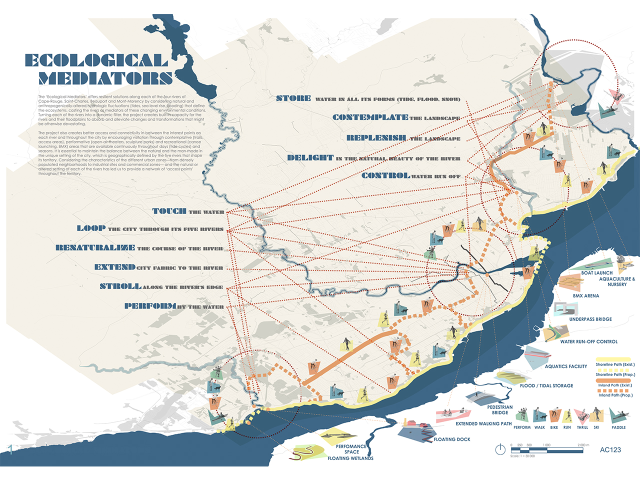
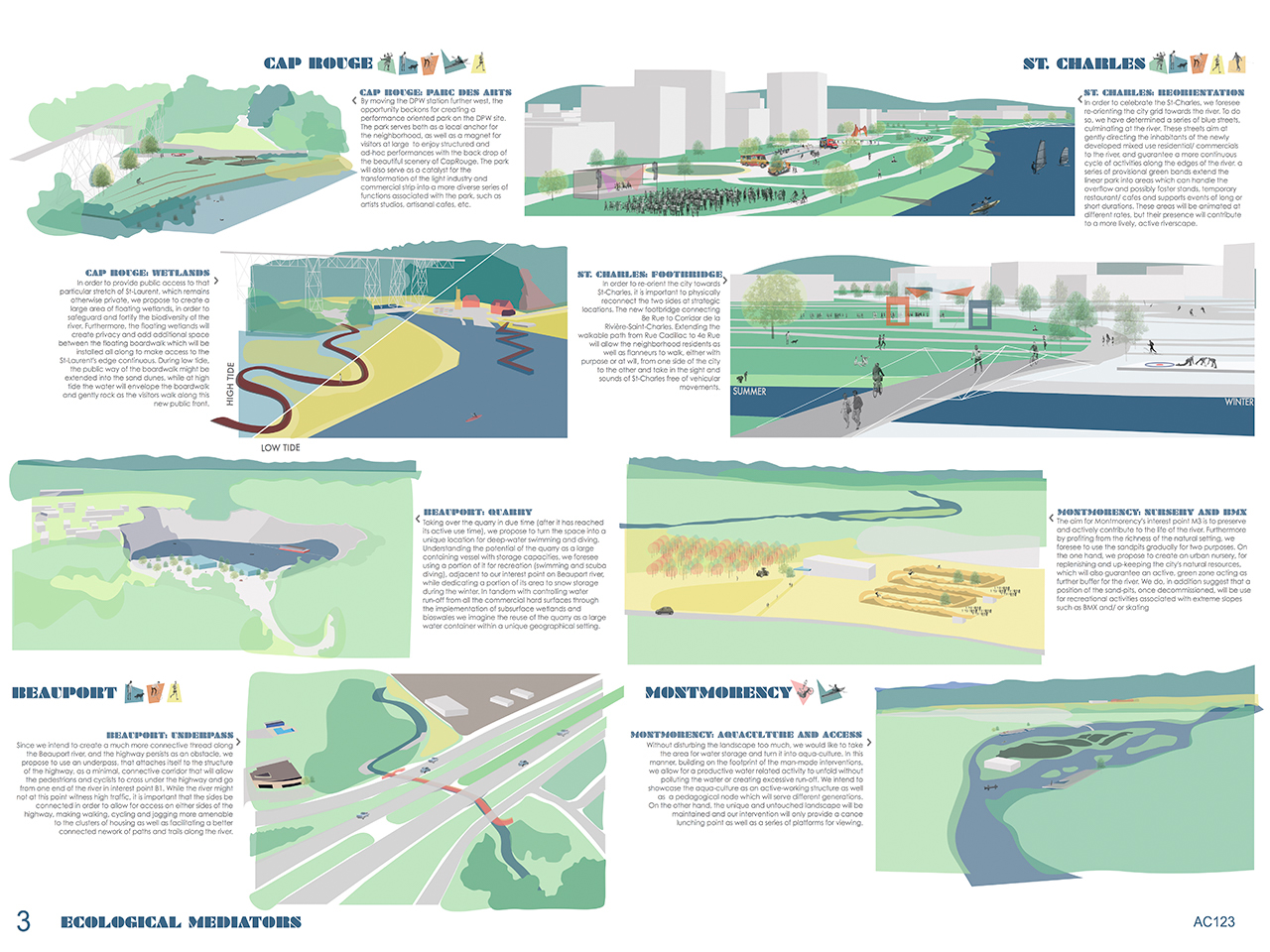
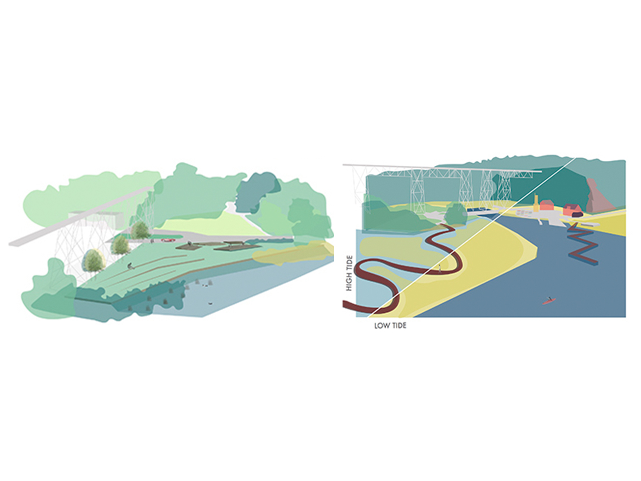
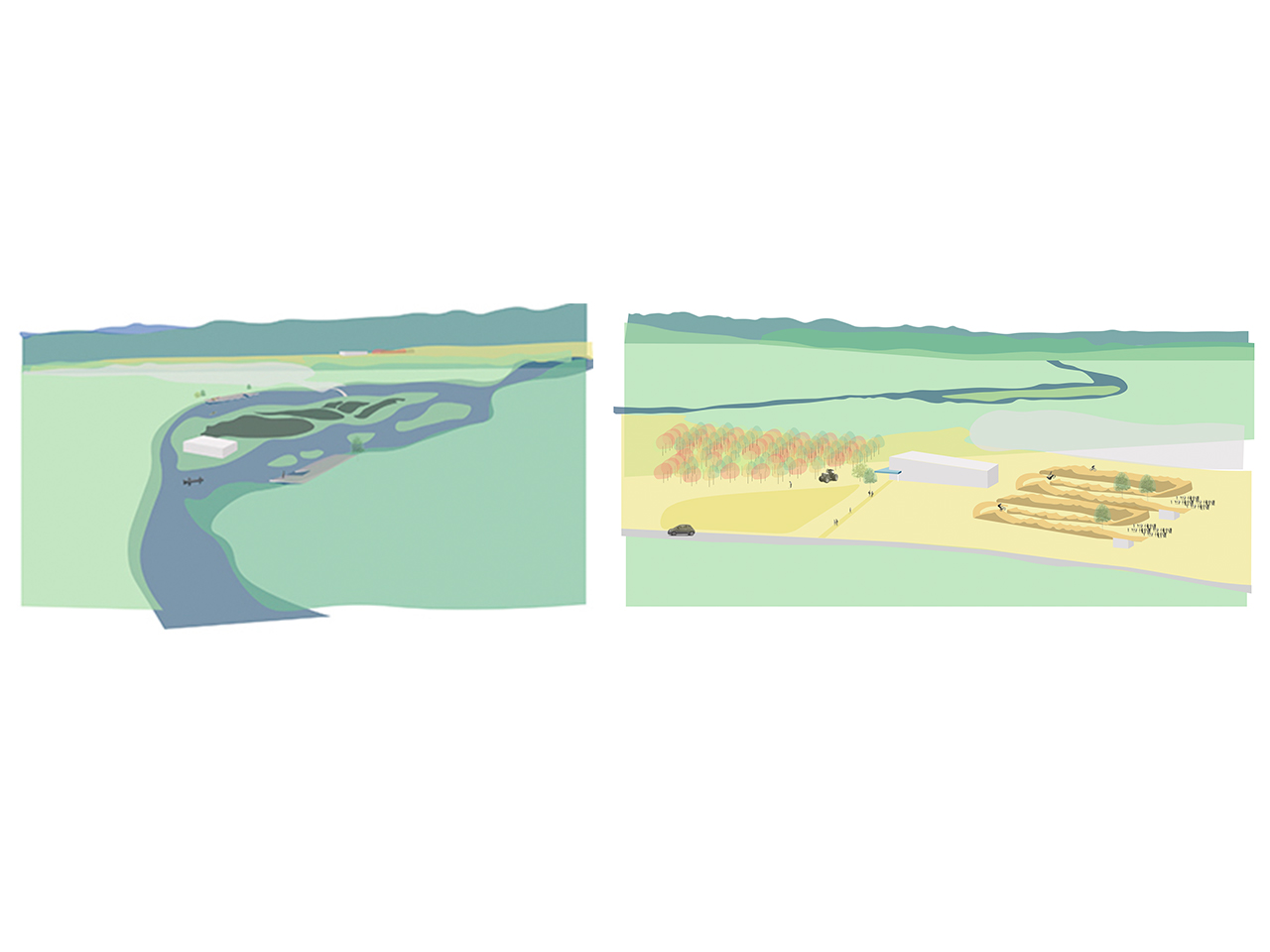
The ‘Ecological Mediators’ offers resilient solutions along each of the four rivers of Cape-Rouge, Saint-Charles, Beauport and Mont-Morency by considering natural and anthropogenically-altered hydrologic fluctuations (tides, sea level rise, flooding) that define the ecosystems, casting the rivers as mediators of these changing environmental conditions. Turning each of the rivers into a dynamic filter, the project creates built-in capacity for the rivers and their floodplains to absorb and alleviate changes and transformations that might be otherwise devastating. The project foresees controlling water runoff by creating treatment trains with both subsurface infiltration/biofiltration
areas and constructed surface wetlands. By designating areas for aquaculture and
urban nurseries, there will be a built-in capacity for growth and replenishment of the
riverscapes both as practical and educational components that complements the
gestures at the landscape and urban level.
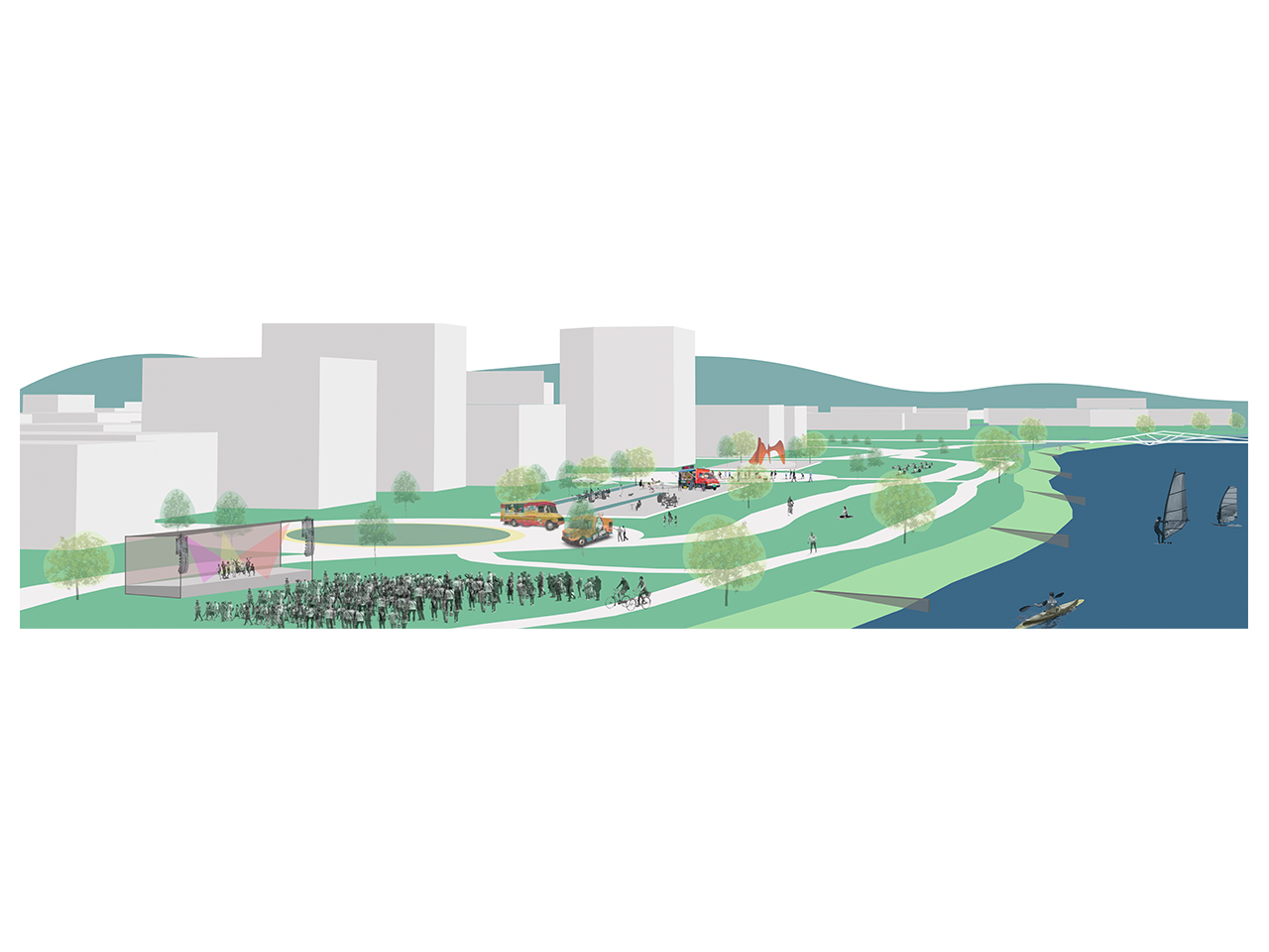
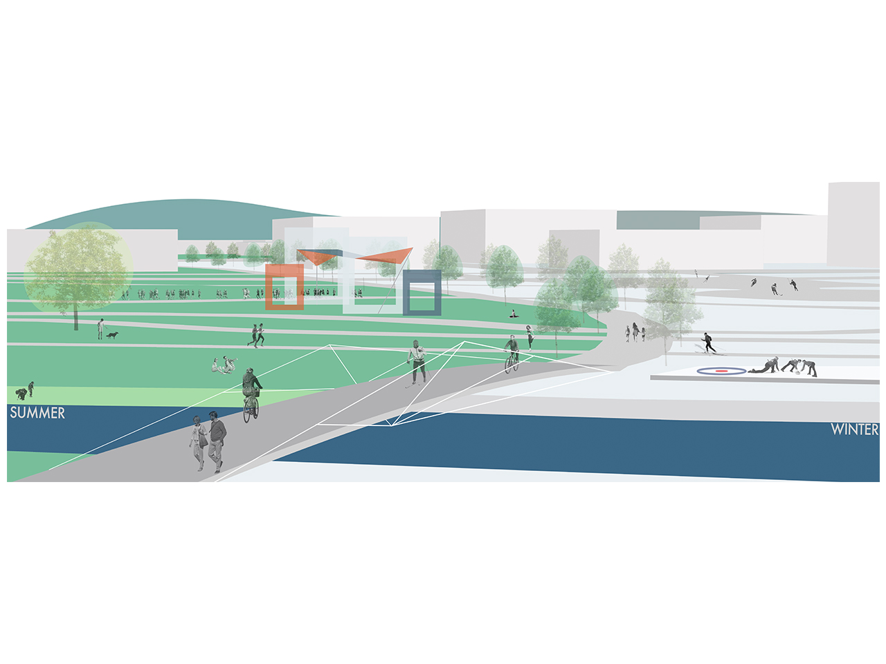
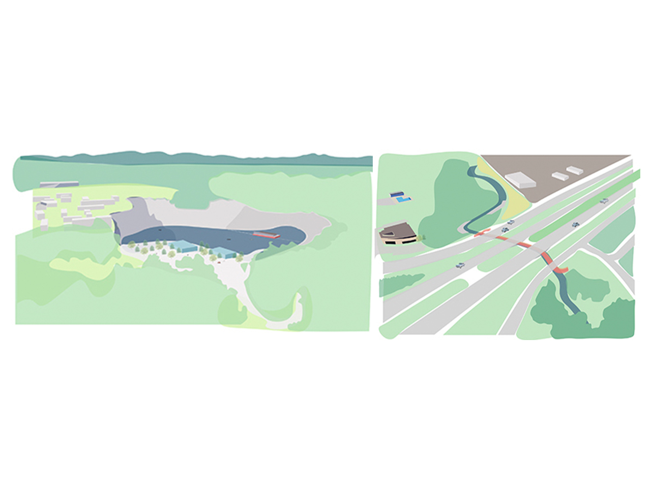
The project also creates better access and connectivity in between the interest points on each river and throughout the city by encouraging visitation through contemplative (trails, access areas), performative (open-air theaters, sculpture parks) and recreational (canoe launching, BMX) areas that are available continuously throughout days (tide cycles) and seasons. It is essential to maintain the balance between the natural and the man-made in the unique setting of the city, which is geographically defined by the five rivers that shape its territory. Considering the characteristics of the different urban zones—from densely populated neighborhoods to industrial sites and commercial zones— and the natural or altered setting of each of the rivers has led us to provide a network of ‘access points’ throughout the territory. By rendering the riverscapes more visible, connected, and accessible, our goal is to make the city-dwellers more aware of the rivers and cognizant of their dynamic temporal characteristics. In addition, we have created continuous access to the shore of St-Lawrence with a second, all-season connected network of trails in parallel further up to the North to create a ‘loop’ that traverses St-Lawrence and returns through a network of paths that would be used for walking, biking, skating, and cross-country skiing.
The project encourages the citizens to appreciate each of the rivers at the macro level by celebrating the geographic and environmental characteristics of each river. At the territorial scale, connecting these rivers in two directions, parallel and perpendicular to St-Lawrence, and creating green pockets along those lines will contribute to a greener, better-connected city.